Unmanned aircraft systems are a rapidly developing technology. The constant improvements and new features that are included in each new UAS can be challenging to learn and keep track of. In this new article series from CompassDrone, we will explore some of the new features of the Matrice 300 drone and Zenmuse H20 camera so that you know what features will matter to your team and to learn how to use the many new features of this top-of-the-line UAS. The first feature we will cover in this series is the Hi-Res Grid Photo.
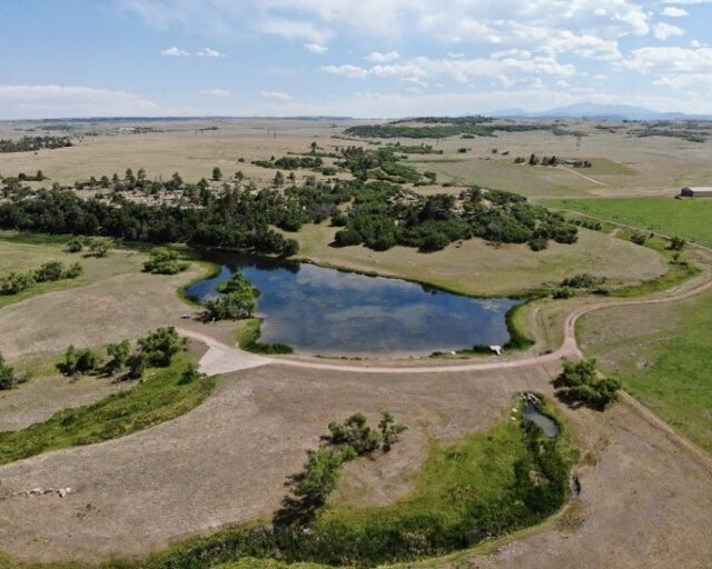
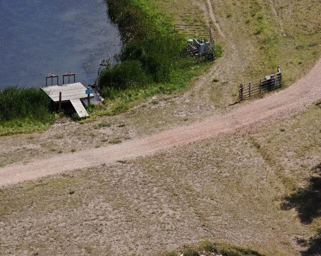
The image above shows a pond in a beautiful rural area. Already one can see the quality in this composite image from the H20 camera. But what if we would like to take a more detailed look at a specific area of the image? This is where the Hi-Res Grid Photo function comes in.
This individual grid image is one of 36 that was used to make the composite image. Some things to notice in the individual grid image are the ripples in the water and the clear view of the bottom of the pond. This is the level of detail that this function of the H20 camera can provide. The number of images that the composite image will be composed of is adjustable as well, so the drone operator can choose from a range of between 9 and 36 images to create the composite image.
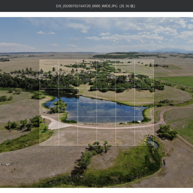
When pulling the images off the SD card from the camera, the composite and individual grid images will be stored in a folder. The composite image’s title will end in 0000_WIDE, and the individual grid photo titles will end in 0001_SUPR, 0002_SUPR, 0003_SUPR, etc. In this folder will also be a chrome HTML document where you can open both the composite and individual images in a convenient DJI Pilot web interface where you can easily switch between images.
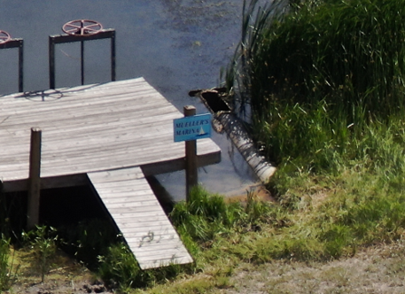
The following images are additional individual grid images to see how the resolution holds up across the composite image. The image of the dock shows how the image is clear enough to read the small sign near it, showing impressive clarity when contrasted with the composite image.
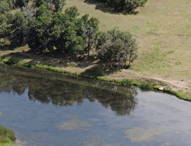
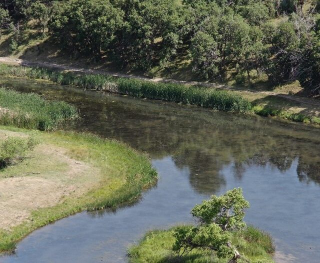
This next image exemplifies how this feature of the Zenmuse H20 camera could be used in an environmental monitoring application. The shoreline can clearly be seen, as well as details of the pond that would allow land managers and government agencies to use this tool to monitor large natural areas more efficiently.
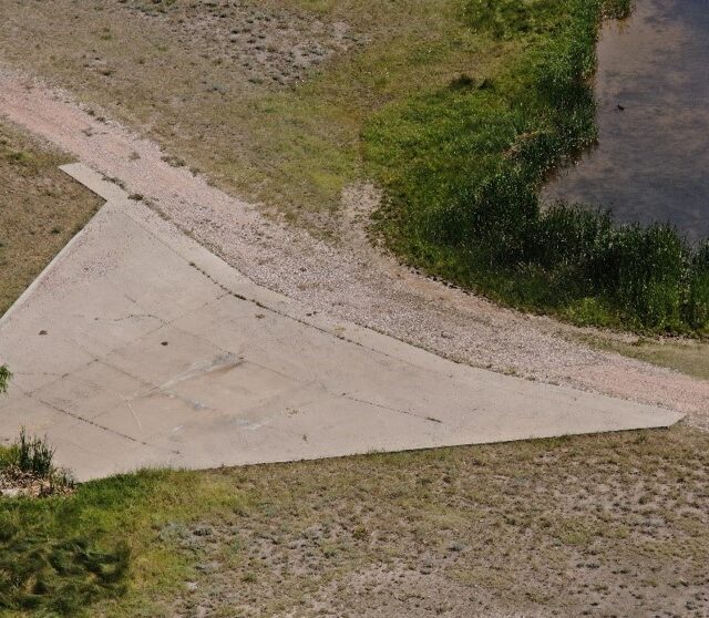
This final image reiterates the usefulness of the camera as an inspector’s tool. In one image an inspector can evaluate all the structures surrounding this pond from a distance, including the dock and drainage structures
Thank you for reading this installment of the CompassDrone article series, “Exploring the Matrice 300”. Do you think your team is ready to add this tool to your toolbox? Contact us for demo, quote, and order at [email protected], calling us at 303-999-3078, or visiting our website https://compassdrone.com/contact-us/.