[email protected]
+1 (303) 999 3078
Contact Us
OneCompass
CompassCom
CompassData
Equipment and Accessories
Drone Software
DroneDeploy
DJI TERRA
CIRRUAS
DJI FLIGHTHUB AND FLIGHT SIMULATOR
DRONE SOLUTIONS
Part 107 Training
Complete Drone Program
RESOURCES
Drone Blog
Events
News
ABOUT US
Terms and Conditions
Privacy Policy
Contact Us
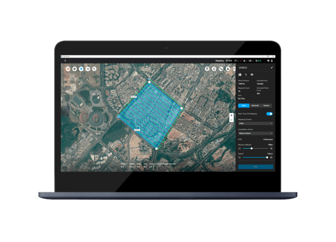
DJI TERRA
Next Gen Mapping Solution
Easy to use mapping software by digitizing the world around you.
Public Safety
Construction
Infrastructure
Agriculture
Mission Planning
Data Acquisition
Area Mapping
Data Analysis
Mapping
2D Maps
Real-Time Mapping
2D Reconstruction
2D Multispectral Reconstruction
3D Maps
Real-Time 3D Point Cloud
2
3D Reconstruction
Data Analysis
2D & 3D Measurements
Annotation
Photo Inspection
PLAN. PROCESS. ANALYZE. EXECUTE. Streamline Your Ops Workflow
For Terra License Plan
Contact Us